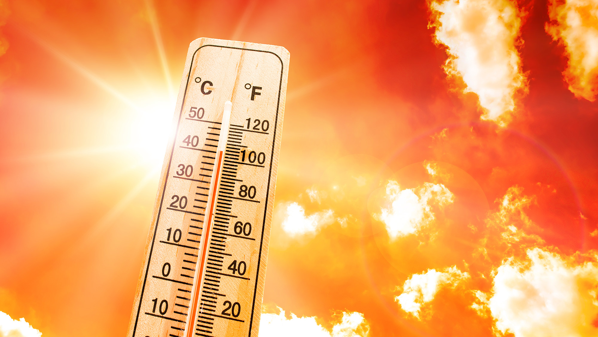
As extreme heat — exacerbated by climate change — becomes a growing threat, researchers at Texas A&M University have developed a cutting-edge tool to better protect our campus community. The study focuses on predicting and mitigating the impacts of outdoor heat stress using advanced digital models and deep learning techniques, marking a significant leap forward in public health preparedness.
The impacts of this research have the potential to extend beyond the College Station campus. By providing a deeper understanding of how extreme heat impacts specific areas over different heatwave periods, this study offers valuable insights that can be applied to other cities and universities. The research creates an opportunity for more informed decision-making, enhancing thermal comfort and building resilience against the increasing frequency of extreme heat events.
The research is led by The Center for Geospatial Sciences, Applications, and Technology and Texas A&M Institute of Data Science-Urban AI Lab and conducted on the Texas A&M University College Station campus. It combines physical microclimate models, highly detailed 3D urban models, and meteorological data to simulate the Universal Thermal Climate Index (UTCI), a widely recognized indicator of outdoor heat stress levels.
“A key innovation in the study is the development of a hybrid neural network model, an advanced form of artificial intelligence that integrates both spatial and temporal data to make rapid predictions of UTCI. This model is capable of analyzing vast amounts of data quickly, providing real-time insights that can be used to predict how heat stress levels will change throughout the day across various campus locations”, said Dr. Xinyue Ye, Harold L. Adams Endowed Professor of Landscape Architecture and Urban Planning, who is also an affiliated faculty member in the Department of Computer Science and Engineering and the Department of Multidisciplinary Engineering.
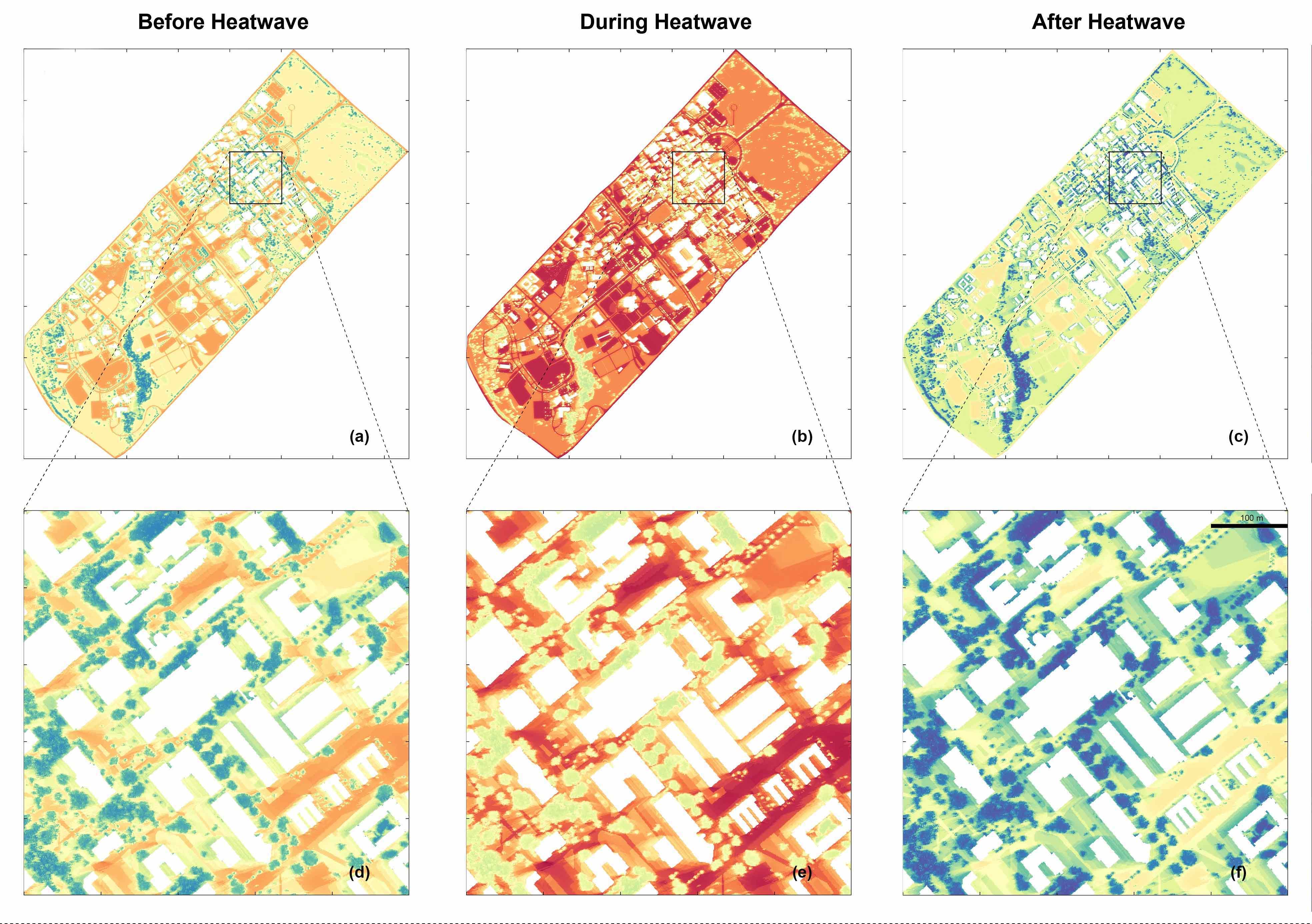
To visualize the heat distribution on campus, the research team created a dynamic digital twin of campus — a virtual model that mirrors the real world and allows for bi-directional information flow. This digital twin integrates physical data from the campus with virtual simulations, offering campus officials, emergency responders and the broader public a powerful tool for responding to heat risks. By visualizing heat stress in real-time, predicting future conditions, and suggesting cooler and shorter routes, this platform empowers decision-makers to take proactive measures, such as adjusting outdoor activities or deploying cooling resources to areas most in need.
There are a variety of factors that can affect heat on different parts of campus, such as shade from buildings or trees and materials used on nearby buildings and pathways. The comprehensive nature of this study takes all of these factors into consideration.
“What sets this study apart is its unprecedented level of detail, with simulations providing a spatial resolution as fine as 1 meter and updating every hour, allowing campus goers to see the heat distribution along their path at different times of day,” said Ye, who also serves as the director of the Texas A&M Center for Geospatial Sciences, Applications and Technology, and the founding director of Urban AI Lab at the Texas A&M Institute of Data Science. “This high-resolution approach provides a much clearer understanding of how heat stress varies across different parts of the campus over time.”
Collaborating with Ye on this research are doctoral students Wenjing Gong, Yifan Yang, and Wenyu Zhang, as well as Dr. Xiao Huang, an assistant professor of Environmental Sciences at Emory University.